Before buying property in Uvita, first confirm whether the lot is titled land or a state concession, and whether any part of it sits inside the 200 metre maritime zone or on protected land. Folio's measurements show that 95.7% of Uvita's maritime strip is covered by registered parcels and roughly half of it overlaps protected land. Pull the registry certificate, the cadastral map and the municipal concession file before you sign anything.
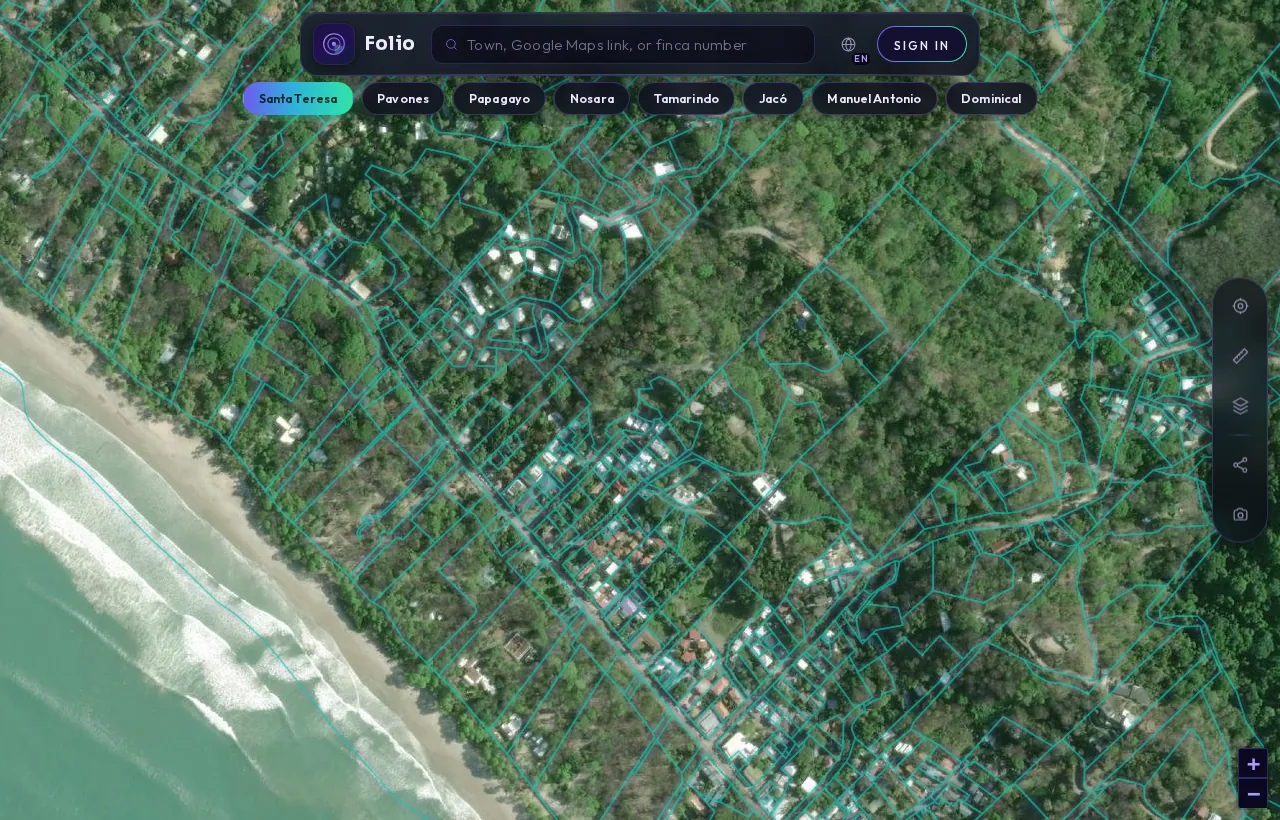
Any parcel, in the Folio app.
Search a town, a Google Maps link or a finca and Folio outlines the registered parcel from the national cadastre, with the maritime line, protected areas and water on top of it, before you call a lawyer or put down a deposit.
See every parcel in Uvita on the map
What the records showUvita's maritime strip in Folio's numbers
From Folio's August 2026 measurement of Uvita's coast in a study of 27 coastal towns; parcel counts are lower bounds.
If you are looking at buying property in Uvita, the coastline is where the records get complicated. Inland lots raise the usual questions about owner, liens and survey. Anything near the beach adds a second layer: the maritime zone, concessions and protected land. Those questions decide what you would actually own.
This note uses Folio's own measurements of Uvita's coast, taken in August 2026 as part of a study covering 27 coastal towns. The parcel counts are lower bounds, not a complete census. They tell you which questions matter here. They do not tell you anything about a specific lot.
What do the maritime zone numbers say about Uvita?
Costa Rica's maritime terrestrial zone, the zona marítimo terrestre (ZMT), is a strip 200 metres wide along both coasts, measured from the ordinary high-tide line. That definition comes from Ley 6043, the maritime zone law published by the ICT. Folio measured that strip along Uvita's coast, in the canton of Osa, Puntarenas, and overlaid registered parcels and protected areas on it.
| Measure (Uvita) | Value | What it means for you |
|---|---|---|
| Area of the 200 m strip | 2.265 km² | The legal maritime zone measured along this town's coast |
| Registered parcels touching the strip | 16 (lower bound) | Parcels whose boundary reaches into the zone, at least partly |
| Registered parcels fully inside the strip | 2 (lower bound) | Parcels lying entirely within the zone |
| Share of strip covered by registered parcels | 95.7% | Almost the whole strip is already spoken for on the map |
| Registered geometry in the first 50 m | 0.4941 km² | Overlap with the public zone that needs explaining |
| Strip overlapping protected land | 1.142 km² | Roughly half the strip, per SINAC data |
You can see the full breakdown on Folio's maritime zone data for Uvita. The figures that matter most for a buyer are the coverage share and the protected overlap.
Does a registered parcel near the beach mean someone owns it?
No. A parcel can appear on the cadastral map because it is a titled property or because it is a state concession, and the map looks the same either way. Folio's mapping cannot tell them apart, and neither can you from a map alone.
The law splits the strip in two. The first 50 metres from the ordinary high-tide line is the Zona Pública (public zone). The remaining 150 metres is the Zona Restringida (restricted zone). The law also treats all mangroves as public zone, whatever their size. In the restricted band, most registered parcels are concessions: a right to use state land for a set term under conditions, not ownership.
So when 95.7% of Uvita's strip shows registered geometry, read it as "almost every piece of this coast has some registered claim on it". It does not mean those claims are freehold titles. Only the registry record, and the municipal concession file if there is one, will say which it is.
For a fuller explanation of how concessions work, read the Costa Rica maritime zone explained for buyers.
Why does registered land inside the first 50 metres matter?
The public zone is meant to stay open to everyone. Yet Folio measured 0.4941 km² of registered parcel geometry overlapping Uvita's first 50 metres. That overlap can have several explanations:
- a lawful concession or arrangement the records support,
- an exception that predates the current maritime zone rules (a pre-1973 exception),
- a mapping offset, where the drawn boundary does not match the ground or the official coastline.
On a map, these three look identical. Only a registry pull and a review by your attorney can separate them. If a lot you are considering touches that first 50 metres, treat it as a question to resolve before any deposit, not a detail to sort out later.
Tap any Uvita lot in the free app to see its boundary and maritime flag.
Check it freeWhat changes when the strip overlaps protected land?
About half of Uvita's maritime strip, 1.142 km² of 2.265 km², overlaps protected land according to SINAC data. That category covers national parks, wildlife refuges and Patrimonio Natural del Estado (state natural heritage).
Where the maritime zone meets protected land, the restrictions are much stricter than ordinary concession rules. Even outside protected areas, the maritime zone law prohibits fencing, cutting trees and similar development in the zone without legal authorization. On protected land the room for any private use narrows further. Ask your attorney which rules apply to the specific lot, and whether any building on it was ever authorized.
Which public records should you pull first in Uvita?
Start with the registry, then the map, then the municipality. A practical order:
- Registry certificate. A certificación literal from the Registro Nacional shows the registered owner, the lot description and any gravámenes (encumbrances) and anotaciones (pending annotations such as lawsuits or liens in process). These are available through the Registro Nacional digital services.
- Cadastral map. The plano catastrado (registered survey) should match both the registry description and what you see on the ground. Check the area, boundaries and access road.
- Maritime zone position. Establish whether any part of the lot falls in the 200 metre strip, and if so, in which band. The exact line matters here because the strip is so heavily registered.
- Concession file, if applicable. For land in the restricted zone, the Municipality of Osa holds the concession records. Ask for the concession's status, term, permitted use and whether fees are current.
- Coastal plan. Concessions depend on an approved coastal zoning plan (plan regulador costero). The ICT's maritime zone programme publishes information on coastal plans and regulations.
- Protected area status. Ask whether the lot overlaps a national park, refuge or state natural heritage land.
- Taxes and water. Confirm municipal taxes are paid and that the lot has legal water availability, not just a hose from a neighbour.
The Uvita property check page is a starting point. Folio's free map shows a lot's finca number, area, perimeter and cadastral boundary, plus a maritime-zone flag. It does not show the registered owner, liens, encumbrances or the plano.
Get the free Costa Rica buyer's checklist
What to ask for, what to pull from the registry and what to confirm on the map before you sign anything. One short email, no spam.
Can a foreigner hold a concession in Uvita?
The law limits it. The maritime zone law states that concessions are not granted to foreigners who have not resided in Costa Rica for at least five years. Ask your attorney whether any other structure, such as a company, is permitted in your case and what conditions would apply. This is squarely a question for your attorney, who can explain which structure, if any, fits your situation.
What questions should you ask the seller in Uvita?
Bring these to the seller and your lawyer, and ask for documents rather than verbal answers:
- Is this titled land or a concession? Please show the registry record that says so.
- Does any part of the lot touch the 200 metre strip, and does any part fall within the first 50 metres?
- Does the lot overlap protected land according to SINAC?
- Were the existing structures built with permits, and in which zone do they sit?
- Does the plano match the registry area and the fences on the ground?
- Are there any encumbrances, annotations or unpaid taxes?
- What is the legal source of water for the property?
If you are looking specifically at oceanfront land, buying a beachfront lot in Costa Rica without the traps covers the questions in more depth.
What can the records not tell you?
Public records show what has been registered and mapped. They do not tell you whether a concession will be renewed, whether a boundary dispute is brewing between neighbours, or whether an unpermitted structure will draw attention. Folio's measurements are lower bounds built from sampling the cadastre, so some parcels near the coast may not be counted at all.
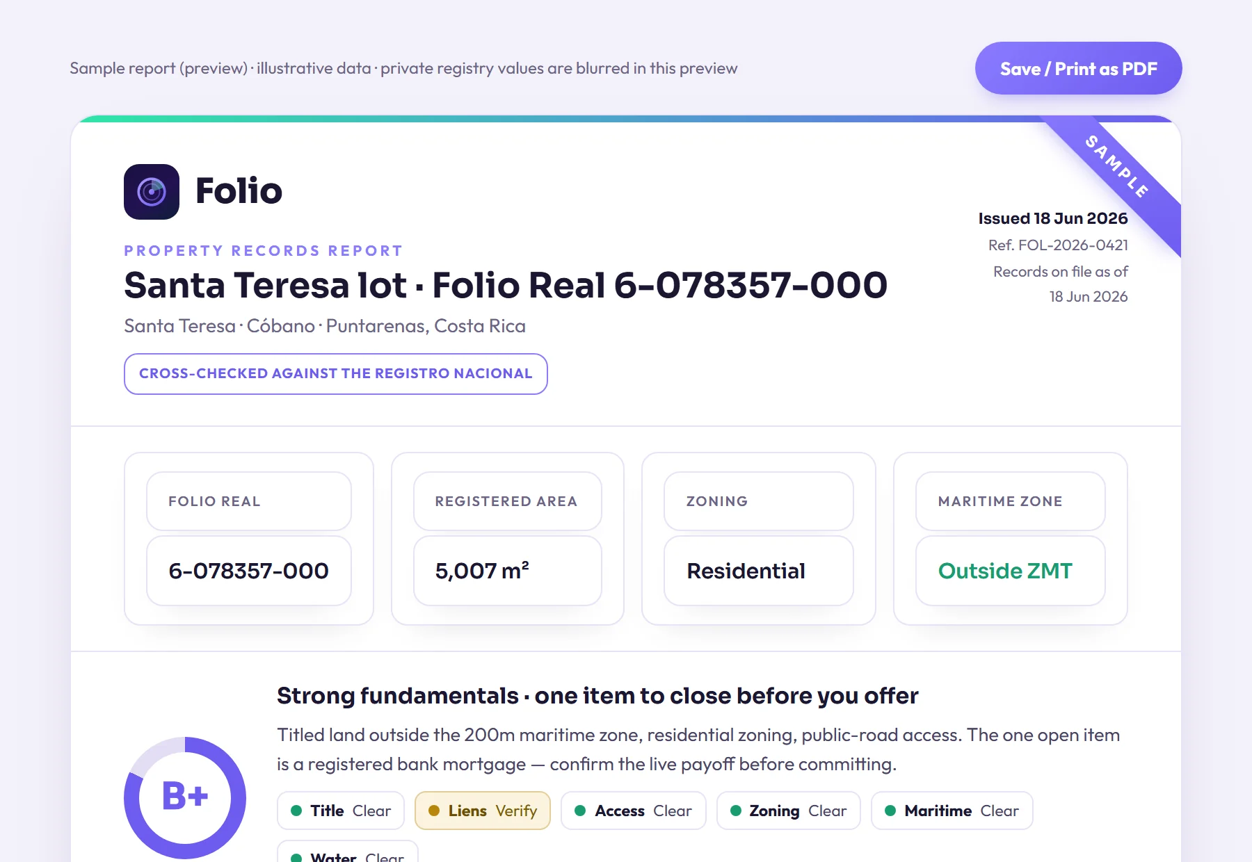
Use the records to narrow down which questions matter, then let a Costa Rican attorney or notary advise on the answers. A verified report from Folio, priced at $29 and delivered within 24 hours, gathers the registered owner, liens, taxes, water rights and the exact maritime line in one place for that conversation.
Know what you're buying before the deposit.
Most problems with a lot don't show up in the listing, and often the seller doesn't know about them either. Folio lets you find them now, before you pay a lawyer to start the purchase.
Frequently asked questions
Is most beachfront land in Uvita titled property?
Not necessarily. Folio found that 95.7% of Uvita's 200 metre strip is covered by registered parcels, but registration does not mean title. In the restricted band most registered parcels are state concessions, and only a registry pull shows which is which.
How many parcels in Uvita touch the maritime zone?
Folio counted at least 16 registered parcels touching Uvita's maritime strip, with at least 2 lying entirely inside it. These are lower bounds from sampling the cadastre, so the true number may be higher.
What does it mean if a lot overlaps the first 50 metres from the high-tide line?
That band is the public zone under the maritime zone law. An overlap could reflect a lawful concession, a pre-1973 exception or a simple mapping offset. Your attorney needs the registry record to tell them apart.
Is protected land a concern in Uvita?
Yes. Roughly half of Uvita's maritime strip overlaps protected land per SINAC data, and restrictions there are much stricter than normal concession rules. Ask your attorney to confirm the status of any lot near the coast.
Can I buy a concession in Uvita as a foreigner?
The maritime zone law says concessions are not granted to foreigners who have not resided in Costa Rica for at least five years. Ask a Costa Rican attorney whether any other structure is available to you and what conditions would apply before you proceed.
Sources
- Registro Nacional digital services (certificaciones and registry consultations), Registro Nacional de Costa Rica
- Ley sobre la Zona Marítimo Terrestre, Ley 6043 (full text published by ICT), Instituto Costarricense de Turismo (ICT)
- Zona Marítimo Terrestre (maritime zone programme, coastal plans and regulations), Instituto Costarricense de Turismo (ICT)
- Folio data: The State of Costa Rica's Maritime Zone 2026 (Folio study; counts are lower bounds); Folio's town page.
Educational, not legal advice. Folio reports what public records show; it does not replace a licensed Costa Rican attorney, notary or surveyor. Confirm material facts with them before any transaction. Photos are illustrative of the region.