Before buying property in Santa Teresa, first confirm whether the land is titled private property or a concession inside the 200 m maritime zone, then pull the registry record for the registered owner, liens and taxes. Folio's measurements show 96.6% of Santa Teresa's maritime strip is covered by registered parcels and roughly 37% of it overlaps protected land, so a map alone cannot tell you what you are buying.
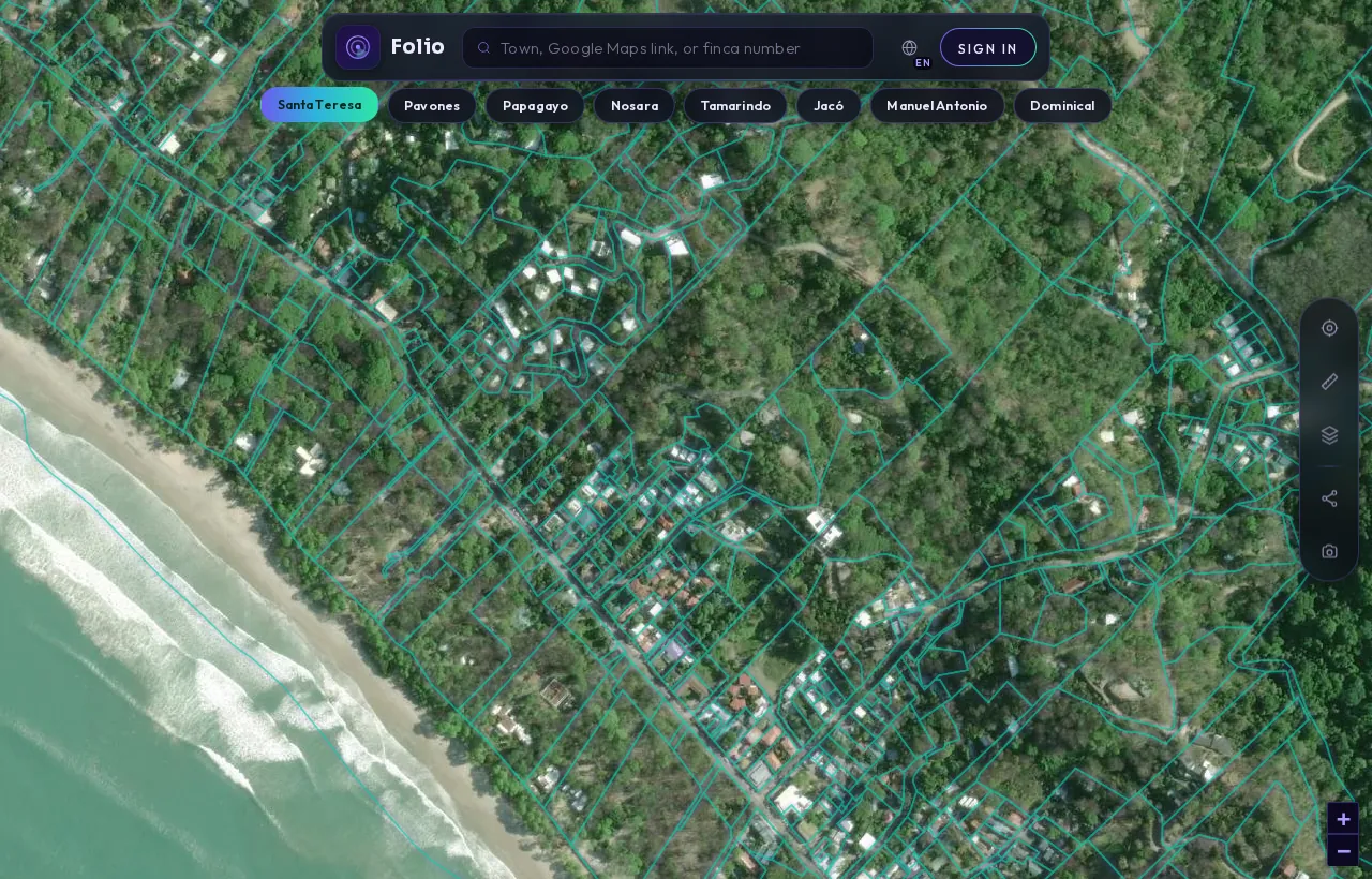
This is Santa Teresa in the Folio app.
Every outline is a registered parcel from the national cadastre. Tap any lot and Folio shows you the maritime line, protected areas and water on top of it, in seconds, before you call a lawyer or put down a deposit.
See every parcel in Santa Teresa on the map
What the records showSanta Teresa's maritime strip in numbers
Folio's own measurements from its maritime zone dataset of 27 coastal towns; parcel counts are lower bounds, so the true figures can only be equal or higher.
Santa Teresa sits in Cóbano, Puntarenas, on the Nicoya Peninsula. It is a surf town where much of the beachfront land lies inside the maritime zone, and where titles are often held inside corporations. Both facts shape your due diligence before you look at a single building permit.
The good news is that Costa Rica's land records are public. Most problems with a Santa Teresa property can be seen before closing, provided you pull the right records in the right order. This note explains what Folio's town data shows, what it means for you, and which questions to put to the seller and your attorney.
Why does the maritime zone come first in Santa Teresa?
Because it decides what kind of right you are buying. Costa Rica's maritime zone law, the Ley sobre la Zona Marítimo Terrestre, defines the zona marítimo terrestre (maritime terrestrial zone, or ZMT) as "la franja de doscientos metros de ancho a todo lo largo de los litorales Atlántico y Pacífico": a strip 200 metres wide along both coasts, measured from the ordinary high-tide line.
That strip has two parts. The first 50 metres is the zona pública (public zone). The remaining 150 metres is the zona restringida (restricted zone). Land in this strip usually cannot be owned outright. In the restricted zone, use is normally granted as a concesión (concession), a right from the state to use the land under conditions, not a freehold title.
The same law also treats all mangroves as public zone, whatever their extent, and prohibits fencing, building or cutting trees in the zone without legal authorization. So if a listing describes "beachfront" or "steps to the sand", the first question is not price. It is whether the land sits in the 200 m strip at all, and if so, in which part. Our plain-English guide to the maritime zone covers the general rules in more depth.
What do Folio's Santa Teresa numbers show?
Folio measured the maritime strip along Santa Teresa's coast as part of a dataset covering 27 coastal towns. The method traces a 200 m landward buffer from the official coastline and then samples the Registro Nacional cadastre to find parcels whose geometry intersects that buffer. The parcel counts are lower bounds: the real numbers can only be equal or higher.
| Measure (Santa Teresa) | Value |
|---|---|
| Area of the 200 m maritime strip | 2.9 km² |
| Registered parcels touching the strip (lower bound) | 133 |
| Registered parcels entirely inside the strip (lower bound) | 24 |
| Share of the strip covered by registered parcels | 96.6% |
| Registered geometry overlapping the first 50 m | 0.7957 km² |
| Strip area overlapping protected land | 1.08 km² |
The full figures and the reading behind them are on the Santa Teresa maritime zone data page. Here is what they mean in practice.
What does "registered" actually mean on this coast?
Santa Teresa's strip is almost entirely spoken for: 96.6% of it is covered by registered parcel geometry. That figure is easy to misread. A parcel showing on the cadastre map does not mean someone holds private title to it.
In the 50 to 200 m band, most registered parcels are state concessions. The cadastre map cannot tell a title from a concession; they look identical. If a seller shows you a plano (survey plan) on the map and calls it "titled", that is a claim to check in the registry, not something the map proves.
The 133 parcels touching the strip matter too. Many lots sit partly inside and partly outside the 200 m line, so a single property can straddle the line. Of those, at least 24 lie entirely inside the strip. If your lot touches the line, you need the exact position of the maritime boundary, not an estimate from a listing photo.
Check any Santa Teresa lot against the maritime line in the free app.
Check it freeWhy does protected land change the picture?
Roughly 37% of Santa Teresa's maritime strip (1.08 km²) overlaps protected land, according to SINAC data: national park, wildlife refuge or Patrimonio Natural del Estado (state natural heritage). In these areas the restrictions are far stricter than the normal concession rules.
For you, this means a lot can be outside the public zone and still be constrained by a protected-area overlay. Ask your attorney to confirm how any overlap affects building and use. Do not assume that because neighbours have built, the same is allowed on your parcel.
What about parcels that overlap the first 50 metres?
The public zone is inalienable: it cannot be sold or privately held in the ordinary way. Yet Folio measured 0.7957 km² of registered parcel geometry overlapping that first 50 m in Santa Teresa.
That overlap has several possible explanations. Some are lawful concessions, some are pre-1973 exceptions, and some are simply mapping offsets where a drawn boundary sits slightly out of place. The map cannot tell these apart. Only a registry pull, read by someone who knows what to look for, can. If a lot you are considering appears to reach the beach, treat that as a question for the registry and your attorney, not a selling point.
Get the free Costa Rica buyer's checklist
What to ask for, what to pull from the registry and what to confirm on the map before you sign anything. One short email, no spam.
Which records should you pull for a Santa Teresa property?
Work through these in order, because each answer changes the next question:
- The maritime line and overlays. Confirm whether the parcel touches the 200 m strip, whether any part falls in the first 50 m, and whether it overlaps protected land or water features. Folio's Santa Teresa property check page shows the cadastre, the maritime line, protected areas and water layers.
- Title or concession. Ask the registry what kind of right is recorded. A titled finca (registered property) and a concession are different legal objects with different rules.
- The registered owner. Pull a registry certificación (certified extract) through the Registro Nacional's digital services. Check that the seller is actually the registered owner, or has authority to sign for it.
- Gravámenes and anotaciones (encumbrances and annotations). Look for mortgages, liens, easements, court annotations and anything else recorded against the property.
- Taxes and local status. Confirm property taxes are paid. Folio's dataset lists the local government here as the Concejo Municipal de Distrito de Cóbano, a district municipal council, so ask your attorney which office holds the records you need.
- The coastal plan. For concession land, ask whether an approved coastal regulatory plan covers the area. The ICT's maritime zone programme publishes information on coastal plans and regulations.
What if the property is held in a corporation?
Titles in Santa Teresa are often held inside corporations. That changes what you need to examine. Besides the property record, you want to know who controls the company, whether it carries debts or obligations of its own, and whether its books and filings are in order.
Concessions add a further layer. The maritime zone law says concessions are not granted "a extranjeros que no hayan residido en el país por lo menos durante cinco años": to foreigners who have not lived in Costa Rica for at least five years. How that rule interacts with a company holding a concession is a question for your attorney, and it deserves a written answer before you sign anything.
Town-specific questions to ask before you commit
- Does any part of the lot fall inside the 200 m strip, and exactly where is the line?
- Is the recorded right a title or a concession? Can the seller show the registry document, not just the plano?
- If it is a concession, what are its term and conditions, and is it current?
- Does the lot overlap protected land or mangroves?
- Does the registered geometry reach into the first 50 m, and if so, why?
- If a corporation holds the property, who are the officers, and what else does the company owe?
- Are permits on file for the existing structures?
For the wider set of traps on coastal lots, see our guide to buying a beachfront lot in Costa Rica. Folio shows what the public records say. Your attorney or notary is the one who advises on what those records mean for your purchase.
Know what you're buying before the deposit.
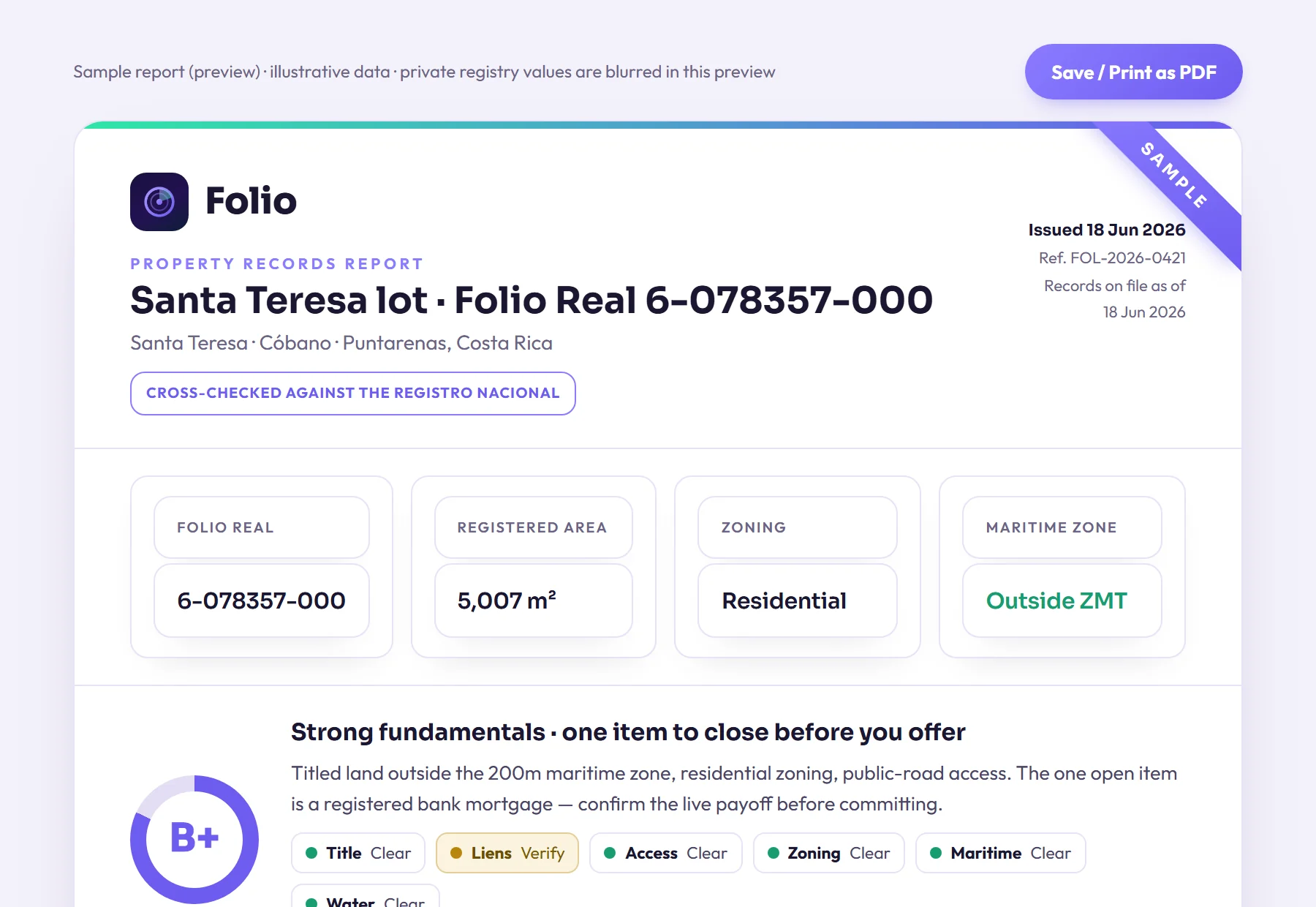
Most problems with a lot don't show up in the listing, and often the seller doesn't know about them either. Folio lets you find them now, before you pay a lawyer to start the purchase.
Frequently asked questions
Can a foreigner buy beachfront property in Santa Teresa?
It depends on where the land sits. Titled land outside the maritime zone is handled differently from concession land inside the 200 m strip, and the maritime zone law says concessions are not granted to foreigners who have not resided in Costa Rica for at least five years. Ask your attorney to confirm which rules apply to the specific parcel.
If a lot appears on the cadastre map, does that mean it is titled?
No. In Santa Teresa, 96.6% of the maritime strip is covered by registered parcel geometry, but in the 50 to 200 m band most of those parcels are state concessions. The map looks the same for a title and a concession, so only a registry record can tell you which one you are buying.
How much of Santa Teresa's coast overlaps protected land?
Folio measured about 1.08 km² of the strip overlapping protected land, roughly 37% of it, using SINAC data. Restrictions in those areas are stricter than the normal concession rules, so check any overlap before planning to build.
Are Folio's parcel counts for Santa Teresa exact?
No. Folio counted at least 133 registered parcels touching the strip and at least 24 lying entirely inside it, and these are lower bounds from sampling the national cadastre. The true figures can only be equal or higher.
Sources
- Registro Nacional digital services (certificaciones and registry consultations), Registro Nacional de Costa Rica
- Ley sobre la Zona Marítimo Terrestre, Ley 6043 (full text published by ICT), Instituto Costarricense de Turismo (ICT)
- Zona Marítimo Terrestre (maritime zone programme, coastal plans and regulations), Instituto Costarricense de Turismo (ICT)
- Folio data: The State of Costa Rica's Maritime Zone 2026 (Folio study; counts are lower bounds); Folio's town page.
Educational, not legal advice. Folio reports what public records show; it does not replace a licensed Costa Rican attorney, notary or surveyor. Confirm material facts with them before any transaction. Photos are illustrative of the region.