Before buying property in Nosara, first confirm whether the land is titled or sits inside the 200 m maritime zone, then check whether it overlaps protected land, because almost all of Nosara's maritime strip does. After that, pull the registry record for the registered owner, gravámenes (encumbrances) and taxes, and have an attorney read it against the survey map.
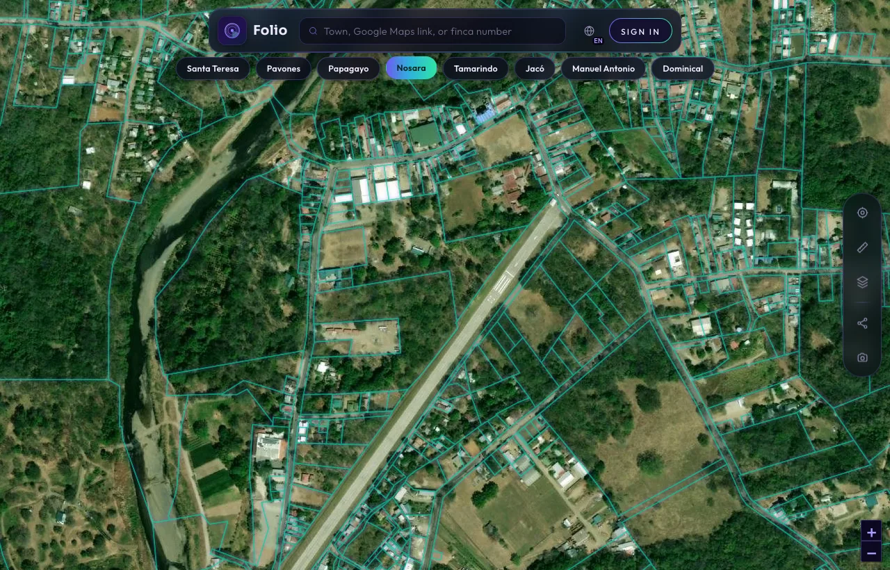
This is Nosara in the Folio app.
Every outline is a registered parcel from the national cadastre. Tap any lot and Folio shows you the maritime line, protected areas and water on top of it, in seconds, before you call a lawyer or put down a deposit.
See every parcel in Nosara on the map
What our measurements showNosara's coast, in four numbers.
Folio measured Nosara's coast on August 2, 2026, using the official coastline, the national cadastre and SINAC protected-area maps. Parcel counts are lower bounds.
Is it titled land, or maritime zone?
On the coast this question comes before everything else. Costa Rica's maritime zone law, Ley 6043, defines the zone in Article 9:
"la franja de doscientos metros de ancho a todo lo largo de los litorales Atlántico y Pacífico"
That is a strip 200 metres wide along both coasts, measured from the ordinary high-tide line. Article 10 splits it in two:
First 50 metres
The Zona Pública. Public and inalienable.
Next 150 metres
The Zona Restringida. Normally held as a state concession through the municipality, not as private title.
"Registered" does not mean "titled".
Nosara's strip is almost fully spoken for: 96.9% of it is covered by registered parcel geometry. But on the cadastre map, a state concession looks exactly like a titled finca. In the 50 to 200 metre band, most registered parcels are concessions. Only a registry pull tells them apart.
Folio also measured 0.3604 km² of registered parcel geometry inside the first 50 metres. That can mean lawful concessions, exceptions that predate 1973, or simple mapping offsets. A map cannot tell you which one applies to a given lot. The registry certificate and a surveyor can.
Is your lot inside the 200 m line? Folio draws it on the map for you.
Check it freeDoes it touch protected land?
This is the number that matters most in Nosara. Of a 1.403 km² strip, 1.397 km² overlaps national park, refuge or State Natural Patrimony land. Nosara is home to a turtle refuge, and where protected land applies, building and concessions are heavily restricted or not possible at all. Listings rarely mention it.
The order that saves you moneyWhich records to pull, and when.
- Map layers first. Check the cadastre outline, the maritime line, protected areas and water features. Folio shows them together for any Nosara finca, free.
- The registry certificate. Request a certificación through the Registro Nacional's digital services. It shows the registered owner, the type of right, gravámenes (encumbrances) and anotaciones (annotations).
- The plano catastrado. Compare the registered survey with what is fenced and built, and with the maritime line and the protected boundary.
- Concession records, if any part sits in the Restricted Zone. Concessions are granted by the municipality, here Nicoya. Ask your attorney whether an approved coastal plan covers the sector.
- Municipal taxes and water. Confirm taxes are paid, and whether the property has a legal water source or connection.
Get the free Costa Rica buyer's checklist
What to ask for, what to pull from the registry and what to confirm on the map before you sign anything. One short email, no spam.
Questions to put to the seller and your attorney.
- Does any part of the parcel fall within 200 metres of the high-tide line?
- Is this a titled finca or a concession? Can I see the registry certificate?
- Does the parcel touch the refuge or any State Natural Patrimony boundary?
- Does the plano match what is fenced and built on the ground?
- Are municipal taxes paid, and is there a legal water source?
Know what you're buying before the deposit.
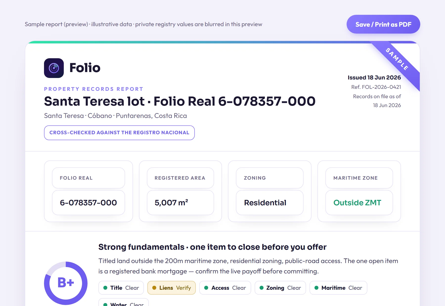
Most problems with a lot don't show up in the listing, and often the seller doesn't know about them either. Folio lets you find them now, before you pay a lawyer to start the purchase.
Frequently asked questions
Can I own beachfront land outright in Nosara?
Land in the first 50 metres from the ordinary high-tide line is inalienable public zone. Registered geometry there can reflect lawful concessions, pre-1973 exceptions or mapping offsets that only a registry pull can tell apart. The next 150 metres is usually held as a state concession rather than titled property. Almost all of Nosara's maritime strip also overlaps protected land, where building and concessions are heavily restricted or impossible, so have an attorney confirm the status of any specific parcel.
If a Nosara lot has a registered survey map, is it titled?
Not necessarily. The cadastre map shows titled parcels and concessions the same way, and in the 50 to 200 m band most registered parcels are state concessions. Only the registry record, read by an attorney, tells you which you are buying.
Can a foreigner hold a maritime zone concession in Nosara?
Costa Rica's maritime zone law bars concessions to foreigners who have not resided in the country for at least five years. Other rules may also apply depending on how a purchase is structured. Ask your attorney to confirm which rules apply to you.
How accurate are Folio's maritime zone numbers for Nosara?
They come from official coastline, cadastre and SINAC protected area data, but the parcel counts are lower bounds from grid sampling. They show the scale of the issue on Nosara's coast. They do not replace a survey or a registry pull for a specific lot.
Sources
- Registro Nacional digital services, Registro Nacional de Costa Rica
- Ley sobre la Zona Marítimo Terrestre, Ley 6043, Instituto Costarricense de Turismo (ICT)
- Zona Marítimo Terrestre programme, ICT
- Folio data: The State of Costa Rica's Maritime Zone 2026 (counts are lower bounds) and Folio's Nosara town page.
Educational, not legal advice. Folio reports what public records show; it does not replace a licensed Costa Rican attorney, notary or surveyor. Confirm material facts with them before any transaction. Photos are illustrative of the region.