Before buying property in Jacó, first find out whether the lot touches the 200 metre maritime zone, because Folio counted at least 193 registered parcels there that do. Then pull the registry certification and the cadastral plan to confirm whether you are looking at titled land or a state concession, and check for liens, encumbrances and any overlap with the public first 50 metres. An attorney should review what the records show before you commit.
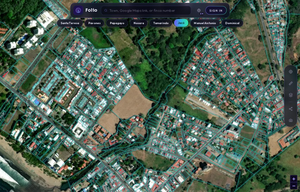
This is Jacó in the Folio app.
Every outline is a registered parcel from the national cadastre. Tap any lot and Folio shows you the maritime line, protected areas and water on top of it, in seconds, before you call a lawyer or put down a deposit.
See every parcel in Jacó on the map
What the records showJacó's maritime strip in numbers
From Folio's August 2026 measurement of Jacó's 200 m strip against the national cadastre; parcel counts are lower bounds.
The first question in Jacó is not about price or view. It is about where the lot sits relative to the coast. Like every Costa Rican coastline, Jacó's carries the 200 metre maritime zone, and that changes what you can own, who can hold it and what you can build.
This note covers what Folio's own measurements show for Jacó, what those numbers mean for a buyer, which public records to request, and the town-specific questions to bring to your attorney.
What do the maritime zone numbers say about Jacó?
Folio measured Jacó's coastline in August 2026 as part of a study of 27 coastal towns. The method traced the legal 200 metre strip from the official national coastline and then matched it against registered parcels in the national cadastre. The full town dataset is on the Folio maritime zone page for Jacó.
| Measure (Jacó, canton of Garabito) | Value |
|---|---|
| Area of the 200 m maritime strip | 3.1 square kilometres |
| Registered parcels touching the strip | at least 193 |
| Registered parcels lying fully inside the strip | at least 108 |
| Share of the strip covered by registered parcels | 46.5% |
| Registered parcel area overlapping the first 50 m | 0.066 square kilometres |
| Strip area overlapping protected land (SINAC data) | 0.031 square kilometres |
Two things stand out. More than half of the parcels that touch the strip sit entirely inside it (108 of 193). And registered parcel geometry still reaches into the first 50 metres, which is the part of the coast the law treats as public.
What does "less than half registered" actually mean?
Only 46.5% of Jacó's maritime strip is covered by registered parcels. It is tempting to read the rest as open land waiting for a buyer. It is the opposite. Unregistered land in the strip is state land with no registered rights at all, so there is nothing for a private seller to transfer.
Registration is not the same as title either. In the band between 50 and 200 metres from the high-tide line, most registered parcels are state concessions, not freehold property. The cadastral map draws both the same way. A boundary on a map tells you a parcel exists in the records; it does not tell you what kind of right sits behind it.
If someone offers you a beachside lot that does not appear in the cadastre at all, treat that as a serious warning sign and stop until an attorney has looked at it.
Why does the first 50 metres matter so much?
The maritime zone law, Ley 6043 (published by the ICT), defines the zone as "la franja de doscientos metros de ancho a todo lo largo de los litorales Atlántico y Pacífico", a 200 metre strip along both coasts. It splits that strip in two:
- Zona Pública (public zone): "la faja de cincuenta metros de ancho a contar de la pleamar ordinaria", the first 50 metres from the ordinary high-tide line.
- Zona Restringida (restricted zone): "la franja de los ciento cincuenta metros restantes", the remaining 150 metres.
The law also says that all mangroves are public zone "sea cual fuere su extensión", whatever their size. So the public area is not always a neat 50 metre line if mangrove is involved.
Folio found 0.066 square kilometres of registered parcel geometry overlapping Jacó's first 50 metres. That overlap can come from three very different things: lawful concessions, exceptions dating from before 1973, or simple mapping offsets where a drawn boundary drifts over the line. A map cannot tell these apart. Only a registry pull and an attorney's review can.
If the lot you are considering is one of the parcels in that overlap, you need to know which of the three applies before you go any further.
Tap any Jacó lot in the free app to see its boundary and maritime flag.
Check it freeTitled land or concession: how do you tell?
This is the single most important fact to settle in Jacó, because the two are different kinds of ownership.
- Titled land (propiedad inscrita): private property registered in the Registro Nacional. It is usually found outside the 200 metre strip, though historic exceptions exist inside it.
- Concession (concesión): a right granted by the municipality to use state land in the restricted zone for a set period and purpose. You do not own the land itself.
Concessions carry rules that matter for foreign buyers. The law says concessions are not granted "a extranjeros que no hayan residido en el país por lo menos durante cinco años", meaning to foreigners who have not lived in Costa Rica for at least five years. How that applies to a company or a particular structure is a question for your attorney, not something to assume from a seller's summary.
Development is also limited. The law prohibits, without proper legal authorization, activities in the zone such as exploiting flora and fauna or putting up fences ("deslindar con cercas"). Before you plan a wall, a pool or a second unit, find out what the concession and the coastal plan actually allow. The ICT's maritime zone programme page is where coastal plans and regulations are published. For the full background, read our explainer on the Costa Rica maritime zone.
Get the free Costa Rica buyer's checklist
What to ask for, what to pull from the registry and what to confirm on the map before you sign anything. One short email, no spam.
Which records should you pull before you sign?
Work through these in order. Each one answers a question the previous one raises.
- Locate the lot on the cadastre. Confirm the finca (property registration) number, lot area, perimeter and boundary, and whether it touches the maritime strip. You can start with the free map on Folio's Jacó check page, which shows those cadastral details and a maritime zone flag.
- Request a registry certification. A certificación from the Registro Nacional's digital services shows who the registered holder is and any gravámenes (encumbrances) such as mortgages, liens, easements or court annotations.
- Get the plano catastrado (cadastral plan). Compare its boundary and area with what is on the ground and in the sale contract. Differences matter more near the coast, where a few metres can move a structure across a zone line.
- Confirm the legal nature of the right. Is it titled property or a concession? If a concession, ask the Municipality of Garabito for the concession file, its term, its permitted use and whether it is current.
- Check the coastal plan. Ask whether a plan regulador costero (coastal zoning plan) covers the area and what it permits on that lot.
- Check taxes and water. Unpaid municipal taxes and the absence of a water availability letter can both stall a purchase or a build.
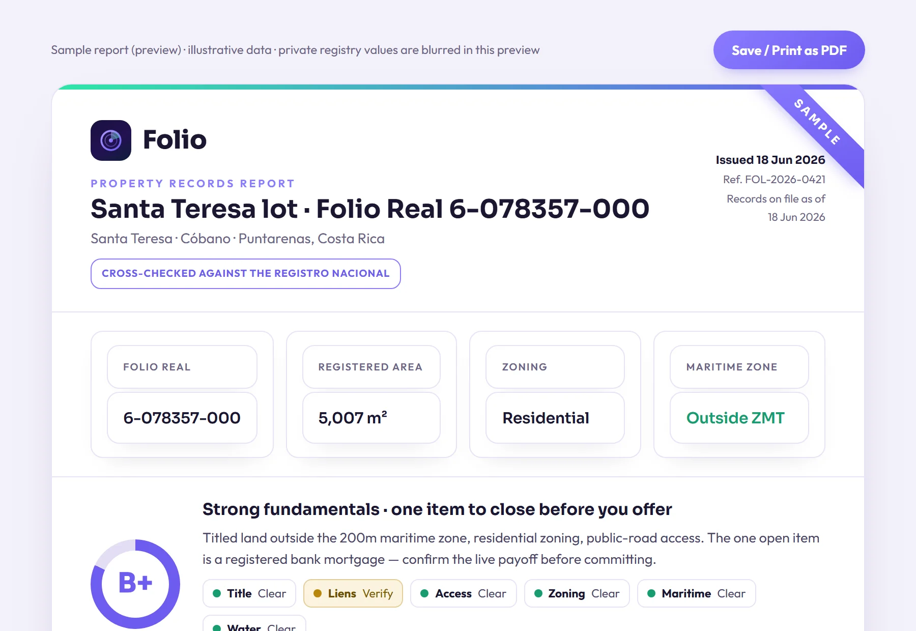
If you would rather have this done for you, Folio's verified report is a human-checked records search covering the registered owner, liens, taxes, water rights and the exact maritime line, delivered within 24 hours for $29. It shows what the public records say. It is not legal advice, and your attorney or notary should still review it.
What should you ask about a Jacó lot specifically?
Bring these questions to the seller and to your attorney. Ask for documents, not reassurances.
- Does the lot touch the 200 metre strip, and if so, is it one of the parcels lying entirely inside it?
- Does any part of the boundary overlap the first 50 metres? If so, is that a concession, a pre-1973 exception or a mapping offset?
- Is there mangrove on or next to the lot that could extend the public zone?
- Is any part of the lot near land the state protects? Folio's data shows a small area of Jacó's strip overlapping protected land.
- If it is a concession, who holds it, when does it expire, and does the holder meet the residency rule?
- Do the existing buildings match what the concession or permits allow?
- Do the registry certification, the cadastral plan and the sale contract all describe the same lot?
Our guide to buying a beachfront lot in Costa Rica walks through these issues in more detail.
How reliable are these numbers?
Treat Folio's counts as a floor, not a total. Parcels were found by sampling the cadastre on a grid, so small lots can be missed. The real number of parcels touching Jacó's strip is at least 193 and could be higher. Across all 27 towns in the study, Folio counted at least 2529 parcels touching the zone and at least 1276 lying fully inside it.
The town figures tell you the coast here is heavily affected by the maritime zone. They cannot tell you anything about one particular lot. For that, you need that lot's own records and an attorney who reads them with you.
Know what you're buying before the deposit.
Most problems with a lot don't show up in the listing, and often the seller doesn't know about them either. Folio lets you find them now, before you pay a lawyer to start the purchase.
Frequently asked questions
Can a foreigner buy beachfront property in Jacó?
It depends on whether the lot is titled land or a concession. Titled property outside the maritime strip can generally be held by foreigners, but the maritime zone law says concessions are not granted to foreigners who have not resided in Costa Rica for at least five years. Ask your attorney how this applies to your situation and any company structure.
How many parcels in Jacó are inside the maritime zone?
Folio's August 2026 measurement found at least 193 registered parcels touching Jacó's 200 metre strip, and at least 108 lying entirely inside it. These are lower bounds, so the true numbers may be higher. They describe the town as a whole, not any single lot.
If a lot in Jacó is registered, does that mean it is titled?
No. The cadastral map shows titles and concessions the same way. In the band between 50 and 200 metres from the high-tide line, most registered parcels are state concessions, so you need a registry certification and the concession file to know which kind of right exists.
What does it mean that only 46.5% of Jacó's strip is registered?
It means more than half of the strip has no registered parcel on it. That land is state land with no registered rights, so it is not available to buy from a private seller. Be very cautious with any offer for coastal land that does not appear in the cadastre.
Where do I find the registered holder and any encumbrances on a Jacó lot?
Request a registry certification from the Registro Nacional, or order Folio's verified report, which covers the registered owner, liens, taxes, water rights and the exact maritime line. Either way, have your attorney or notary review the records before you commit to anything.
Sources
- Registro Nacional digital services (certificaciones and registry consultations), Registro Nacional de Costa Rica
- Ley sobre la Zona Marítimo Terrestre, Ley 6043 (full text published by ICT), Instituto Costarricense de Turismo (ICT)
- Zona Marítimo Terrestre (maritime zone programme, coastal plans and regulations), Instituto Costarricense de Turismo (ICT)
- Folio data: The State of Costa Rica's Maritime Zone 2026 (Folio study; counts are lower bounds); Folio's town page.
Educational, not legal advice. Folio reports what public records show; it does not replace a licensed Costa Rican attorney, notary or surveyor. Confirm material facts with them before any transaction. Photos are illustrative of the region.